One thing we have not mentioned yet, is that our daily progress over the last two days has in part been dictated by the tides. A section of our route today can only be traversed at low tide, so we had to make sure we timed it correctly.
One unfortunate consequence of our timing was that we picked a bad place to stay last night, Le Barre de Monts. It’s on the map, even had a fairly nice Chambre d’Hotes, but there really isn’t a town there! For the first time since our last trip in France in 2005, we were skunked for supper, and had only our emergency rations to eat. Breakfast wasn’t much better, with the usual bread and jelly. We did not find any protein until lunch – a bit hard on cyclists.
But our timing was perfect. First we got to cross a modern bridge to the Island of Noirmoutier.

Going to the Island was in fact our most direct route to the north. But from this bridge, just 2.5 hours before low tide, we looked to the north where our road was to continue, and could see nothing but water.
We next rode across the Island to Le Gois.

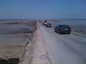
This would be our passage back to the mainland. It is only open for 1.5 hours either side of low tide. In fact, when we arrived – the middle of the roadway was still submerged, and we got to see it rather quickly uncovered as the tide ran out.
We have now learned that this area has a 5 meter tide! That makes for very dramatic changes, quite rapidly. We watched as the roadway dried and hundreds of people headed out across the tidelands looking for shellfish. We are near a full moon so this was a lower than usual tide.

Unfortunately, in our excitement of doing the crossing, we forgot to take pictures with the iPhone, so the best ones will have to wait to be posted after the trip.
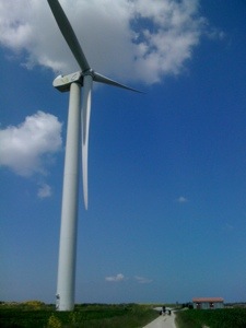
Our next bit of excitement (you know, for a cyclist), was an opportunity to get the closest we had ever been to wind turbines.

That’s Jon and the bike on the lower right. We still had headwinds today, but they were a little lighter.
Next we passed through several small coastal fishing villages “on hold” till the tides would come back again. This picture shows more accurately what a 16 foot tide is like;

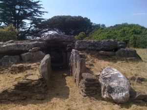
And our final spot on the day’s itinerary, was Dolmen de la Joseliere.

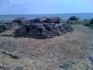
This was a ruin of a tomb from the Neolithic period. On the following picture you can see that it is almost right on the ocean, on the right is another Nazi bunker, and – faintly on the horizon above the tomb, you can almost make out the wind turbines we had passed earlier in the day.

